Once the design route confirmed, the following step is the control point assignment, central points of the road design staking out, and topographic survey of the strip road, to provide complete and accurate geographic information for the road construction, and calculate line and curves parameters.
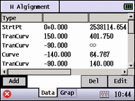
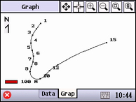
When all the parameters calculated, with the “Road” function of N4, surveyors can easily be guide to input the road elements and parameters step by step, such as horizontal alignment with its start port, straight line, cycle curve and transition curve, in the mean time, graphic of H alignment data can be shown clearly.


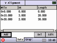
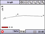
Vertical alignment is composed by cross points which include chainage, elevation and length of the curve.


After the horizontal alignment and vertical alignment being set, all the points can be calculated and saved as the coordinate data , which can be staked out by point stake-out program.

Multi data transferring methods make the surveying job intelligent
Point stake-out program is used very often in the preliminary measurement. There must be thousands of points to stake out during the road construction survey. Besides normal cable, U-disk, SD transferring, NTS-N4 has Bluetooth transferring method. Leave the laptop in the office, coordinate file can be transferred to the site by any mobile phone application via the internet, surveyor can easily import the file from mobile photo to total station through Bluetooth. What’s more, the collected data can be transferred to office directly in the same way.


