


Here we have excited news to share with customers that our field controller software EGStar for iOS is available in Apple Store, customers can install this software on their iPhone or iPad devices to operate the RTK receivers for surveying jobs, which will be new and enjoyable experience for them.
EGStar for iOS is developed by SOUTH R&D teams who invest long time and efforts to finish this project. SOUTH insist to providing affordable hardware with good quality and powerful software easy to use, so as to help customers to finish job successfully and enjoyably.
Currently EGStar for iOS is free to download and install in App Store, customers can try most of functions for whole survey project. Next we would like to introduce the features of this version briefly. if want to get more, kindly go to Apple Store to install and try.

Start-ups
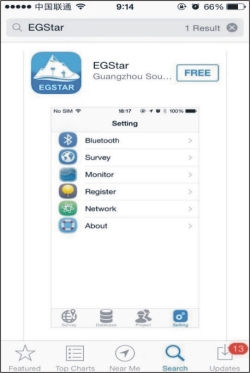
Run Apple store in apple devices, and search EGStar to get it (Fig1).

Fig1. EGstar app in Apple Store
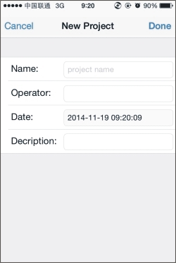
In this page, customer can new job and set coordinate system and transformation parameters (Fig2).

Fig2. New project
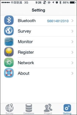
In this page, it include all functions of EGStar, customers can bond receiver by blue tooth, start to survey, monitor the satellite information, register receiver and set Ntrip parameters etc.(Fig3).

Fig3. Main function list
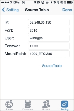
In this page, input Ntrip parameters to get mountpoint list and select the proper one to access Ntrip server to get correction (use GPRS data of mobile device, rather than put SIM card in receiver)(Fig4).

Fig4. Ntrip parameters
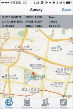
In this page, the position and solution quality information are shown on the top of the interface. Meanwhile, the app can also call the map of iPhone or iPad to show the estimated location of user. Click the Save button to record coordinates (Fig5).
Fig5. Survey interface
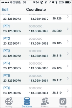
In this page, user is able to manage all the coordinates recorded easily, also can check the points of different projects and edit them (Fig6).

Fig6. Coordinates database


