Unmaned Surface Vehicles
Echo Sounders
Side Scan Sonars
Acoustic Doppler Current Profilers
Total Stations
Electronic Theodolites
Digital Levels
Automatic Levels
Handhelds Distance Meters
Prisms/Tripods/Poles/Staffs...
Mapping Drones & Payloads
UAV Applications
Terrestrial Laser Scanners
LiDARs
SLAM LiDAR
Satellite Imagery
Automatic Deformation Monitoring Systems
Environmental Monitoring Systems
Relevant Sensors
VR Simulated Surveying Training Systems
Auto Steering
Track Geometry Measuring Trolley Systems
Automated Tunnel Scanning & Inspection Systems

Model: SAG600
Features
Specification
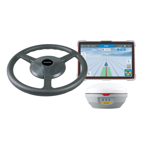
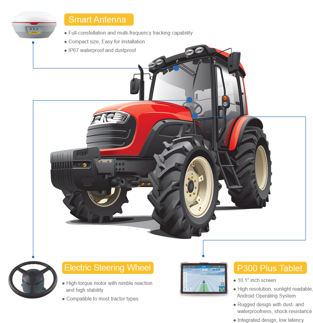
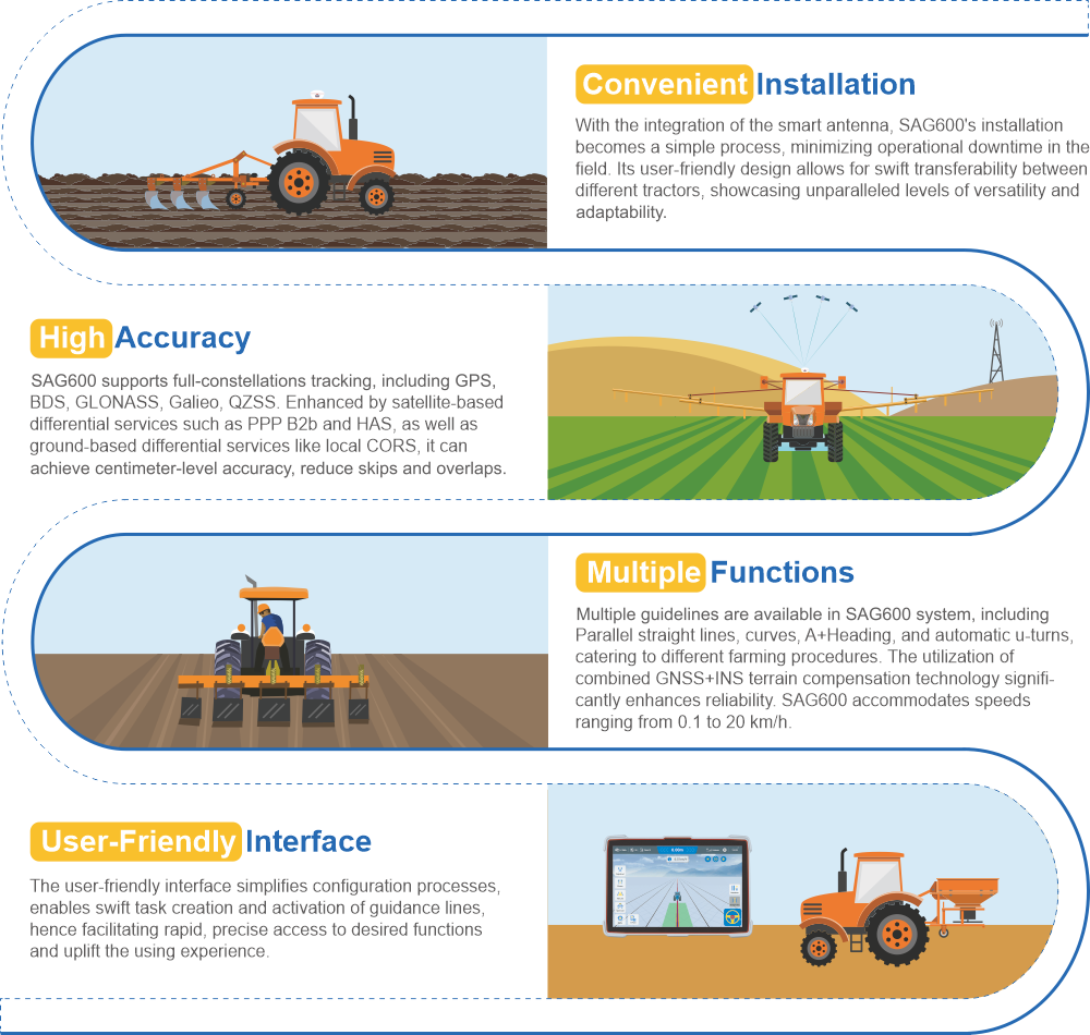
The SAG600 is an automated steering system that uses a smart antenna. The system combines the advantages of convenient installation, high torque, high precision, low noise, and quick troubleshooting in a single package. GNSS+INS terrain compensation technology ensures 2.5 cm pass-to-pass accuracy on any terrain and provides superior performance for sowing, cultivating, trenching, ridging, spraying, transplanting, land consolidation, and harvesting. This system accommodates an extensive range of agricultural machinery, such as seeder, rice transplanters, sprayers, and harvesters.

Convenient Installation

| Positioning Accuracy | Real time kinematics (RTK) | 8mm+1ppm (Horizontal) 15mm+1ppm (Vertical) |
| Velocity accuracy | <0.02 m/s | |
| Initialization Time | <10 s | |
| Initialization reliability | 99.9% | |
| Performance | Pass to pass accuracy | ±2.5cm |
| Work speed | 0.1~20km/h | |
| Work scene | Low / High speed, Straight / Curve Automatic U-turn | |
| Physical | Operating Temperature | -30°C~+70°C |
| Storage Temperature | -40°C~+85°C | |
| Electric Streering Wheel | Power input | 12V~24V |
| Torque | 6.2 N·m | |
| Motor height | 94.3 mm | |
| Motor diameter | 171 mm | |
| Wheel diameter | 380mm | |
| GNSS Tablet | Size | 10.1” |
| Resolution Rate | 1280*800 | |
| Memory | 2GB RAM (4GB is optional) 16G ROM (64GB is optional) |
|
| Operating System | Android 9 | |
| Waterproof and dustproof | IP66 | |
| Signal Tracking | GPS | L1, L2, L5 |
| BDS | B1l, B2l, B3l, B1C, B2a, B2b | |
| GLONASS | L1, L2, L3 | |
| Galileo | E1, E5b, E5a, E6, E5 AltBOC | |
| QZSS | L1, L2, L5 | |
| NAVIC | L5 |
Note: all information above is subject to change without any prior notice.
38