Unmaned Surface Vehicles
Echo Sounders
Side Scan Sonars
Acoustic Doppler Current Profilers
Total Stations
Electronic Theodolites
Digital Levels
Automatic Levels
Handhelds Distance Meters
Prisms/Tripods/Poles/Staffs...
Mapping Drones & Payloads
UAV Applications
Terrestrial Laser Scanners
LiDARs
SLAM LiDAR
Satellite Imagery
Automatic Deformation Monitoring Systems
Environmental Monitoring Systems
Relevant Sensors
VR Simulated Surveying Training Systems
Auto Steering
Track Geometry Measuring Trolley Systems
Automated Tunnel Scanning & Inspection Systems
Features
Applications
Specification
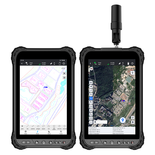
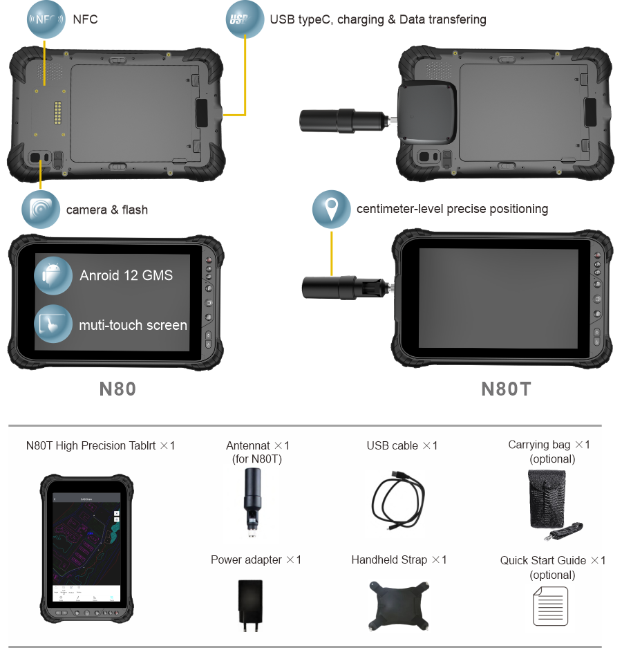
The N80/N80T stands out as an industrial GNSS tablet, featuring an integrated high-precision GNSS board, a highly sensitive antenna, a 5G network modem, WiFi connectivity, and Bluetooth modem. Renowned as the premier portable high-precision tablet, it excels in large-size screen mapping applications. In the current landscape, the Internet permeates every facet of modern industry, catalyzing an unparalleled overhaul and reconfiguration of survey practices. In this era of rapid growth, the imperative of data sharing is unmistakable, and the N80/N80T aptly aligns with the demands of the mapping and GIS industry, thanks to its high-speed communication modem.
N80T | OS | Android 12 |
CPU | 2.4 GHz 8-core processor | |
RAM | 6GB (8GB optional) | |
ROM | 128GB (256GB optional) | |
TF card | supports | |
Rear camera | 16MP | |
Front camera | 8MP | |
Screen | 8-inch capacitive multi-touch screen, 700 Cd/m², Corning Gorilla,Sun Readable 1280*800 (1920*1200 optional) |
|
WiFi | 802.11 a/b/g/n/ac, 2.4GHz/5GHz | |
Cellular | GSM: 850/900/1800/1900 EVDO: BC0 WCDMA: B1/B2/B5/B8 TD-SCDMA: B34/B39 TDDLTE: Band38/Band39/Band40/Band41 FDDLTE: Band1/Band2/Band3/band4/band5/Band7/ band8/band17/band20/band28 5G: N41/N78/N79 |
|
SIM card | two nona SIM card slots | |
BT | BT5.1 | |
NFC | supports | |
GNSS channel | N80: 72 channels N80T: 1408 channels |
|
GNSS signal | N80: GPS L1 GLONASS L1 GALILEO E1 BD B1 N80T: GPS L1C/A/L1C/L2P(Y)/L2C/L5 BDS B1I/B2I/B3I/B1C/B2a/B2b GLONASS G1/G2/G3 Galileo E1/E5a/E5b/E6 QZSS L1C/A/L1C/L2C/L5 NavIC L5 SBAS L1C/A Single Point Positioning (RMS): Horizontal: 1.5 m Vertical: 2.5 m DGPS (RMS): Horizontal: 0.4 m Vertical: 0.8 m RTK (RMS): Horizontal: 0.8 cm + 1 ppm Vertical: 1.5 cm + 1 ppm |
|
Sensor | Ambient light sensor, Digital compass, Gyroscope sensor, Gravity sensor | |
USB | type-C, charge and data transfer | |
Button | volume +/-,menue, home, back, F1, F2, Power | |
Battery | 8000mAh, 3.8V, Li-ion battery, 15h. Charging time 3 to 4 hours. Minimum duration of 15 hours |
|
Quick-charge | QC3.0 | |
Free fall resistance | 1.2m, MIL-STD-810G | |
IP | IP67 | |
Operation temperature | -20℃~60℃ | |
Storage temperature | -40℃~70℃ | |
Humidity resistance | 95% without condensation | |
Size | N80: 243.3*153.5*18mm N80T: 343.3*153.5*32.5m |
|
Weight | N80: 630g N80T: 670g |
Note: all information above is subject to change without any prior notice.
2079